Research
All research are wrong, but some are useful.
I have a broad research interest in Geospatial Data Science including geospatial artificial intelligence (GeoAI) algorithm development, spatiotemporal big data analytics, cartography and geo-visualizations. My work focused on modeling and understanding human-environment relationships at place, and tackling real-world challenges in urban systems such as public health, real estate, and socio-spatial inequality, reflected in the following three aspects:
1. an emphasis on place to observe human dynamics and subjective experiences;
Enrich Geospatial Data Science with Human Experiences at Place
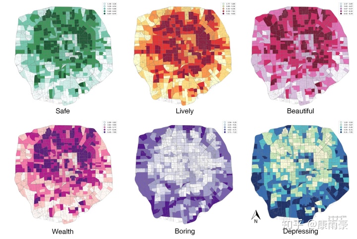
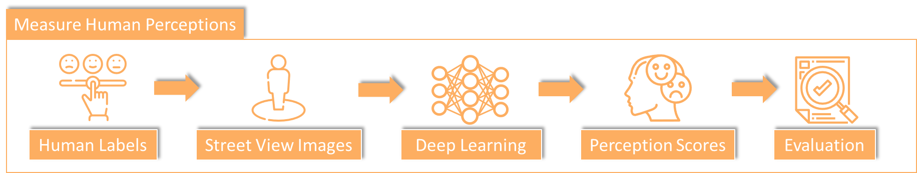
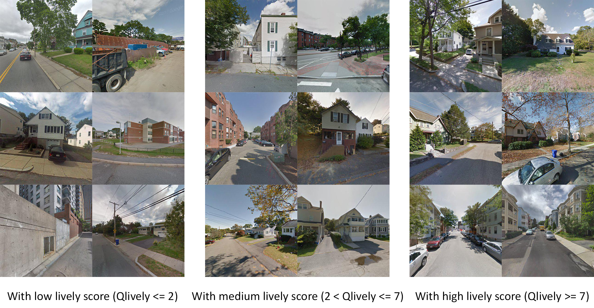
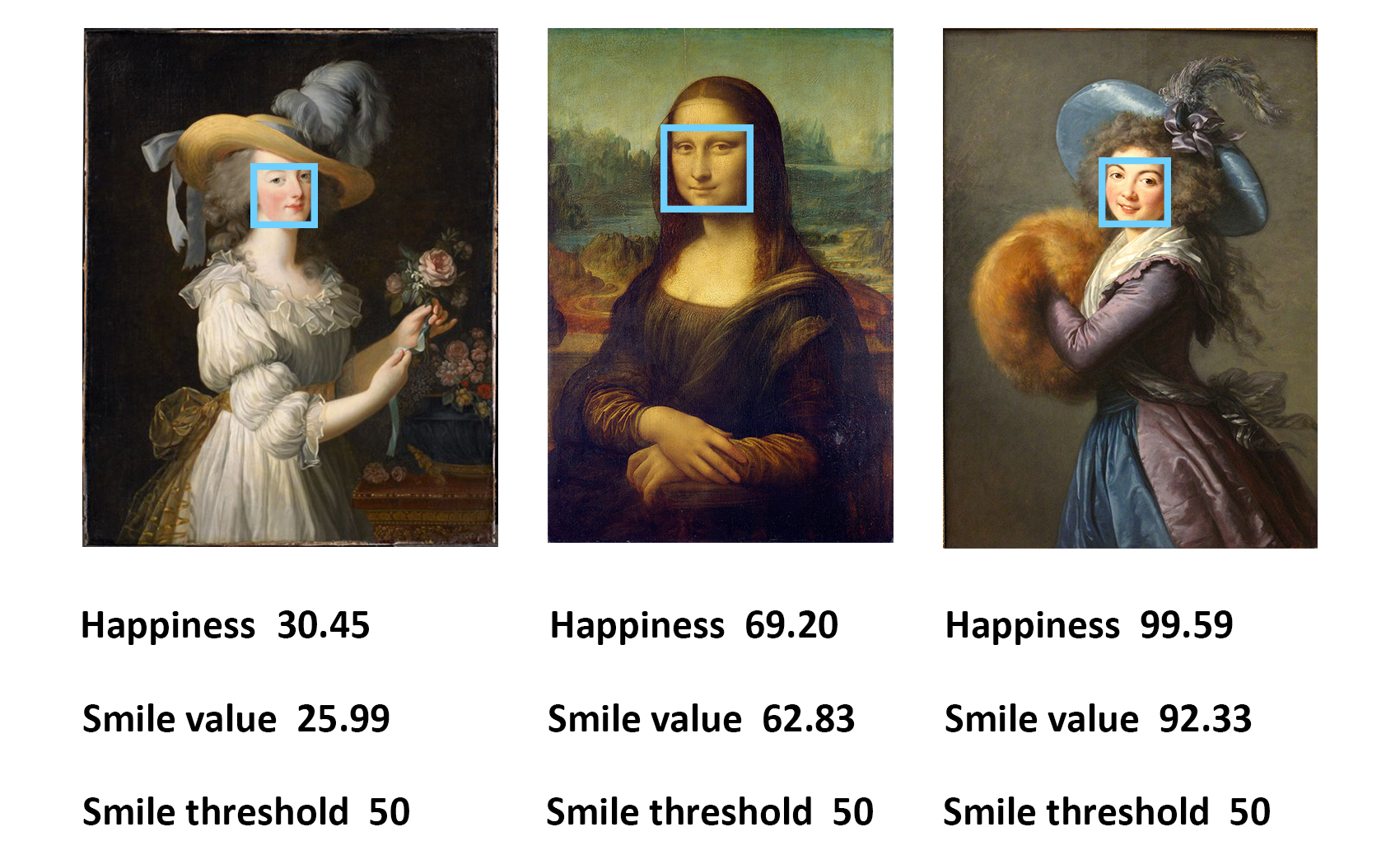
How can we effectively enrich geospatial data science with human experiences at place? My work mainly focused on two aspects of human sense of place: human perceptions of place, and human emotions at place. We have proposed several geocomputational frameworks to measure human perceptions of place from multiple dimensions, such as whether a neighborhood is perceived as a lively, playable, safe, and beautiful place. Also, multiple dimensions of human emotions (e.g., happiness, neutral) are evaluated from users’ facial expressions in photos. Regarding the methodology, we combined street view images, geotagged social media photos, and deep learning methods to measure the human sense of place.
Several selected publications:
(1) We compared the GeoAI-based safety perceptions and traditional survey-based safety perceptions to understand their characteristics and examine perceptual differences in Stockholm, Sweden. We suggested that both approaches have their pros and cons and could be utilized supplementary in planning practices. [Paper]
(2) We assessed the values of “home” from a place-based perspective including human perception and human dynamics rather than simply modeling “house”, which indicates the significant role of sense of place in modeling human-environment relationships. [Paper]
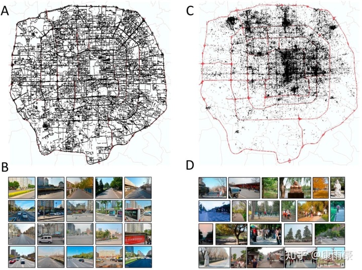
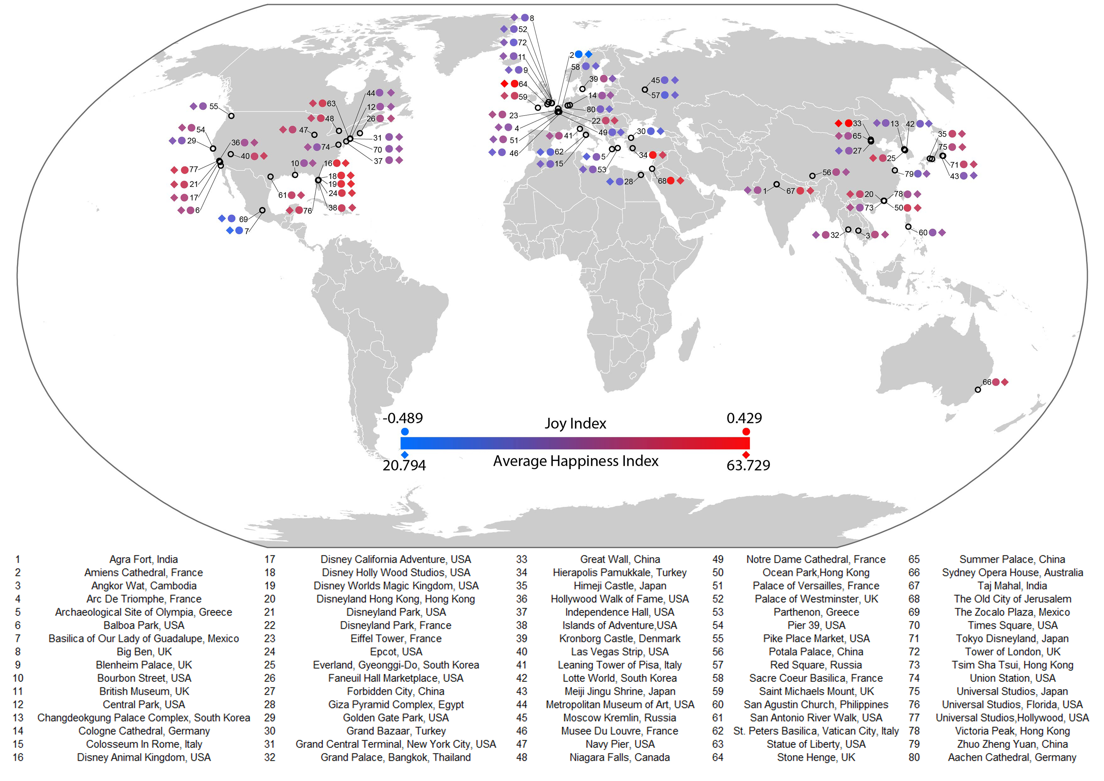
(3) We evaluated human emotions in global tourist attraction places, and we discovered that open space and more greenery have positive impacts on human emotions. [Paper]
(4) We examined the mismatch - perception bias - between people’s visually perceived safety and the actual crime rates, and found that ore visits at night implies places being “more dangerous than they look”. [Paper]
(5) We identified places that are playable for children as they may benefit childhood development and well-being. [Paper]
(6) We propose a data-driven approach using social media check-ins and street-level images to uncover inconspicuous yet popular restaurants and beautiful but unpopular outdoor places. [Paper]
Develop Ethical Cartography and GeoAI Approaches
Developing advanced geocomputing and cartography methods is always an important part of GIScience research. We have made efforts to develop state-of-the-art GeoAI methods by integrating artificial intelligence such as machine learning, deep learning in geographic studies such as map style transfer, geoprivacy protection, and spatial clustering.
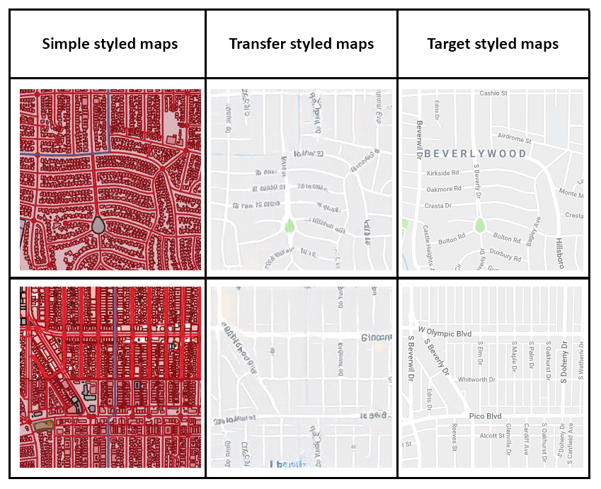
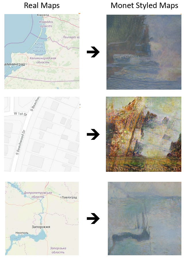
(1) Map style transfer: Advanced generative adversarial networks (GANs) is employed to transfer map style from a specific map to another map (e.g., a vector data without styles can be rendered with Google map styles). [Map Style Transfer Paper]
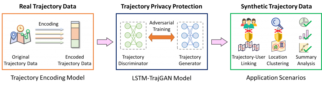
(2) Geoprivacy: To protect human geoprivacy and prevent the disclosure of individual identity at places, we proposed novel deep learning algorithms by generating “fake” trajectory data that mimic real-world individual trajectories. [LSTM-TrajGAN Paper] [Code]
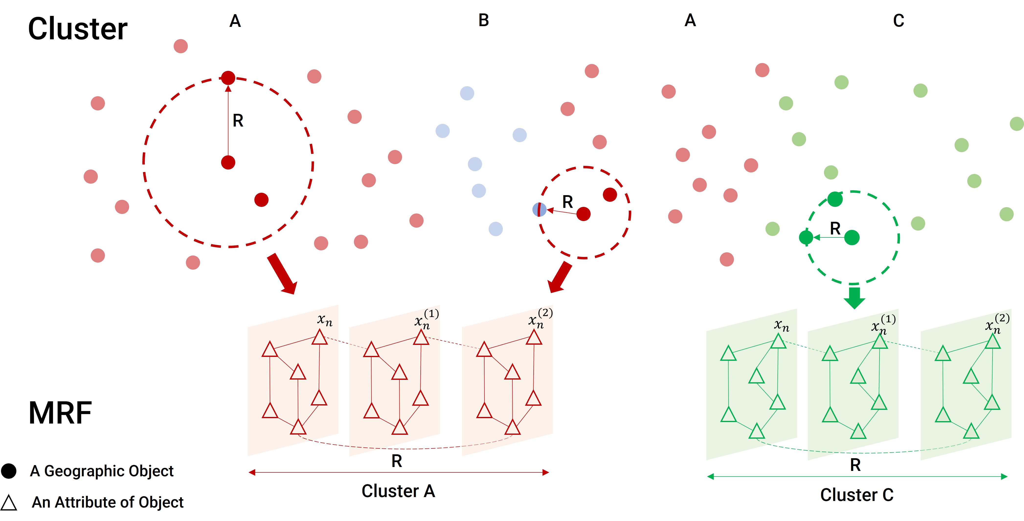
(3) Spatial clustering: A multivariate spatial clustering method for repeated geographic pattern discovery with consideration of spatial contiguity is proposed with machine learning. [STICC Paper] [Code]
Tackle Health, Real Estate, and Socio-spatial Inequity Challenges
I have collaborated with multi-disciplinary researchers and explored how to integrate geospatial data science to benefit research in public health, real estate, and socio-spatial inequality.
Public Health
The COVID-19 pandemic was a global threat presenting health, economic and social challenges that continue to escalate. As a key contributor of an NSF-Rapid funding project, I employed geospatial data science to evaluate the risk of epidemic transmission and help effectively monitor social distancing policies to support decision-making. More specifically, we:
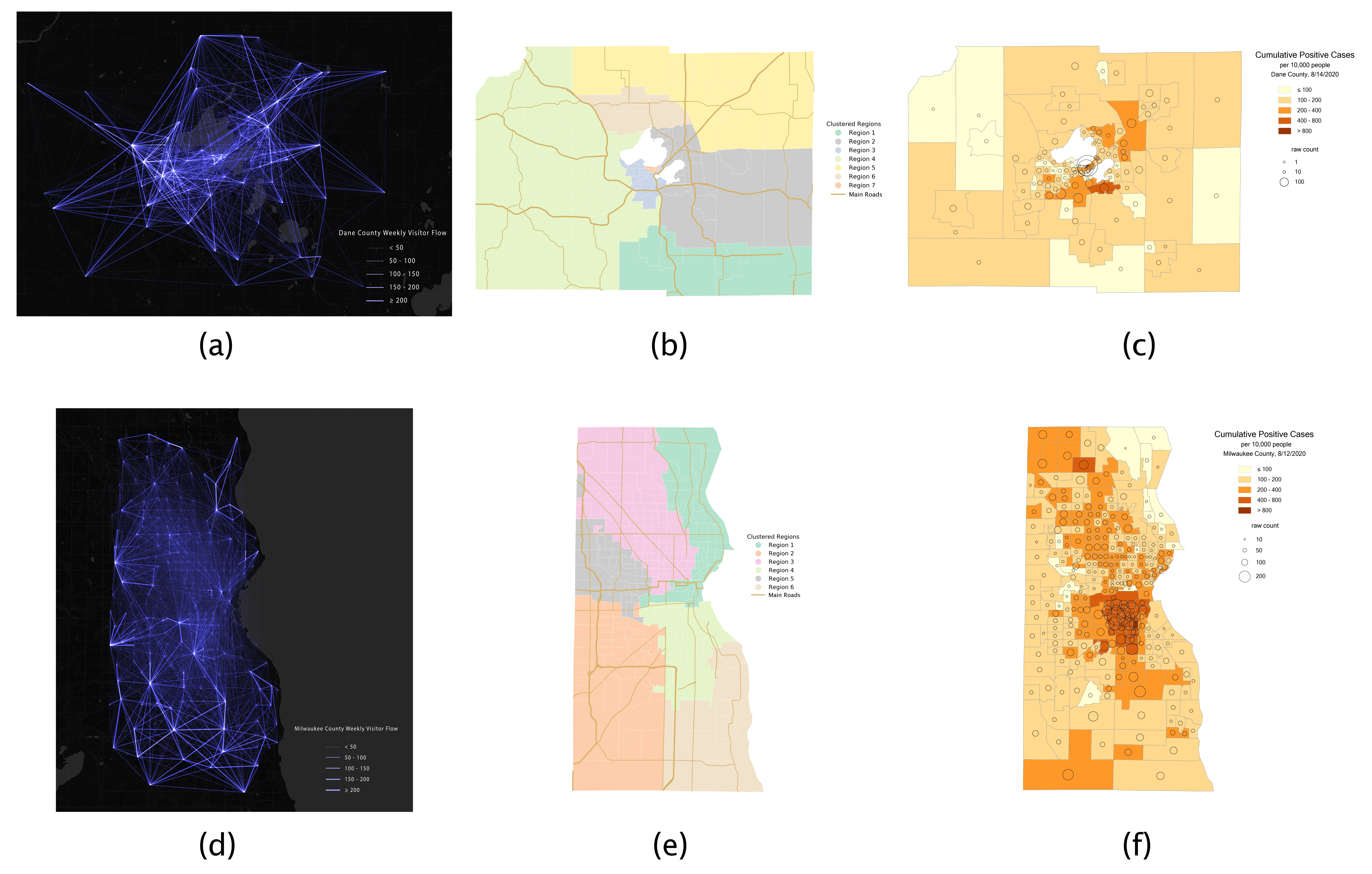
- Generated an open-sourced high-resolution human dynamic mobility flow dataset; [Dataset] [Paper]
- Designed an interactive mapping platform to show how people reacted to the social distancing guidelines; [Dashboard] [Paper]
- Developed a mathematical model to forecast the number of infections under different scenarios; [Paper]
- Examined the associations between human mobility changes and stay-at-home mandates; [Paper]
- Investigated how spatial-racial inequality has influenced the spread of COVID-19. [Paper]
By creating the dataset, developing the web platform and the spatial model, analyzing the spatial patterns, and providing policy-making suggestions, we show how geospatial data science could be used for health geography. The entire project attracted over 20 media coverage and TV interviews at the national level.
Selected media coverage:
- CNN Health: https://edition.cnn.com/2020/09/08/health/stay-at-home-orders-coronavirus-study-wellness/index.html
- Fox47 – Madison http://fox47.com/news/local/uw-madison-researchers-map-travel-data-to-combat-pandemic
- NBC 15 https://www.nbc15.com/2020/10/07/tracking-movement-in-wisconsin-leading-up-to-latest-health-order/
Real Estate
I employed large-scale datasets with machine learning modeling the real estate market to understand the human settlements for policy-making.
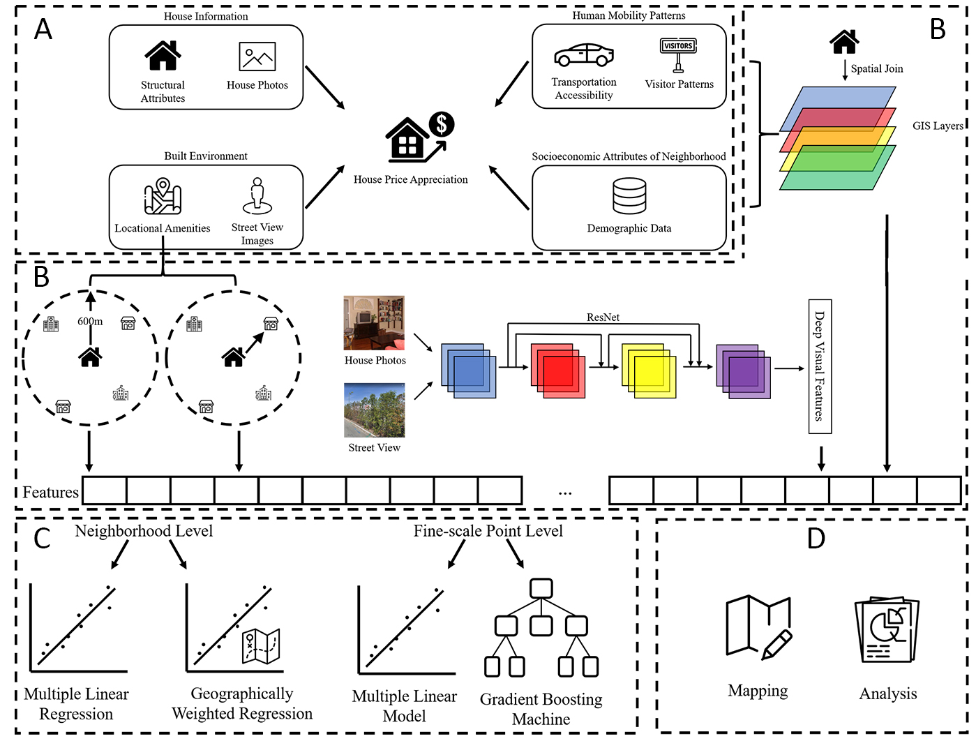
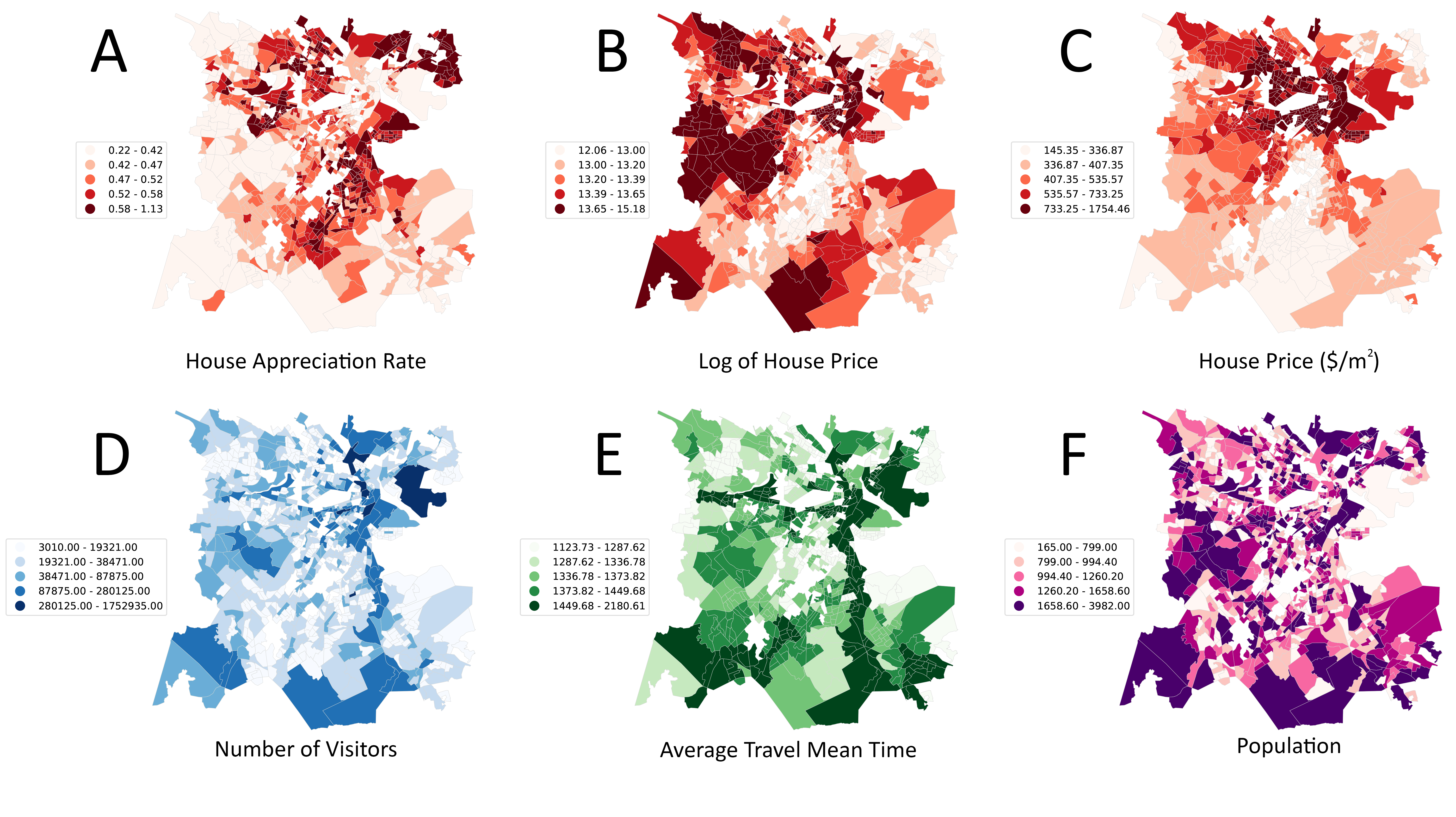
(1) A computational framework is proposed to estimate house price appreciation using multi-source urban big data fusion including high-dimensional visual features from street view images. We use machine learning for the prediction of house price appreciation. [Paper]
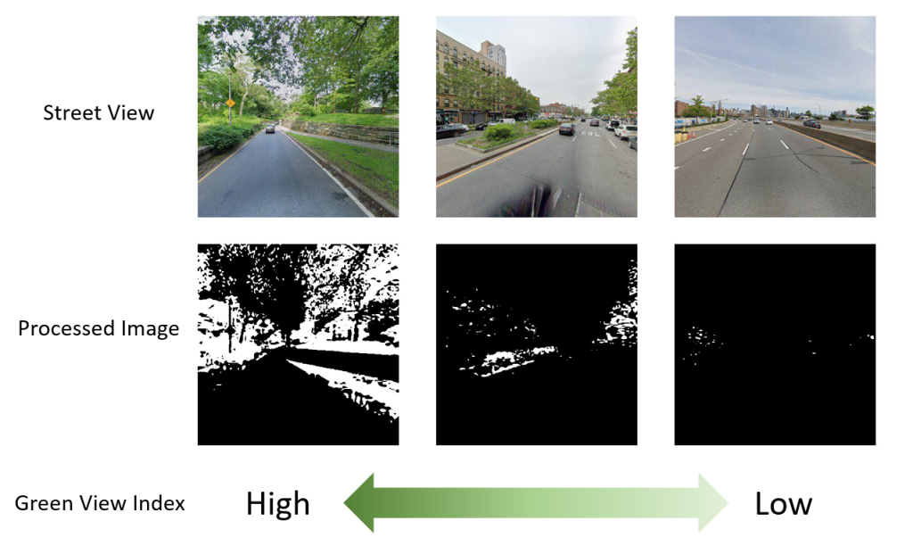
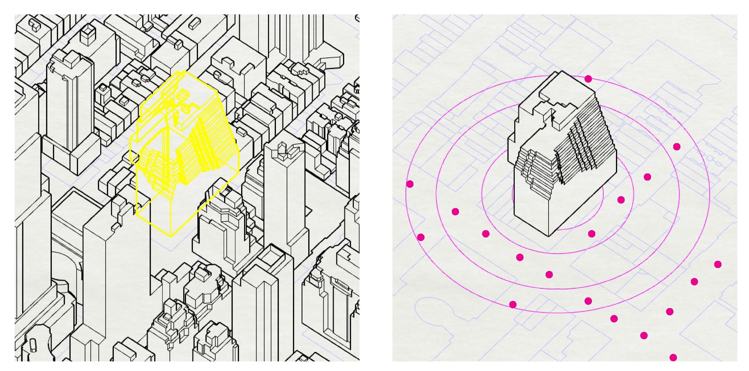
(2) We measured the effects of urban greenery on New York commercial buildings to understand the economic role of urban landscape. [Paper]
Socio-spatial Inequality
We have observed and analyzed socio-spatial inequalities to help neglected groups and reduce socio-spatial inequality.
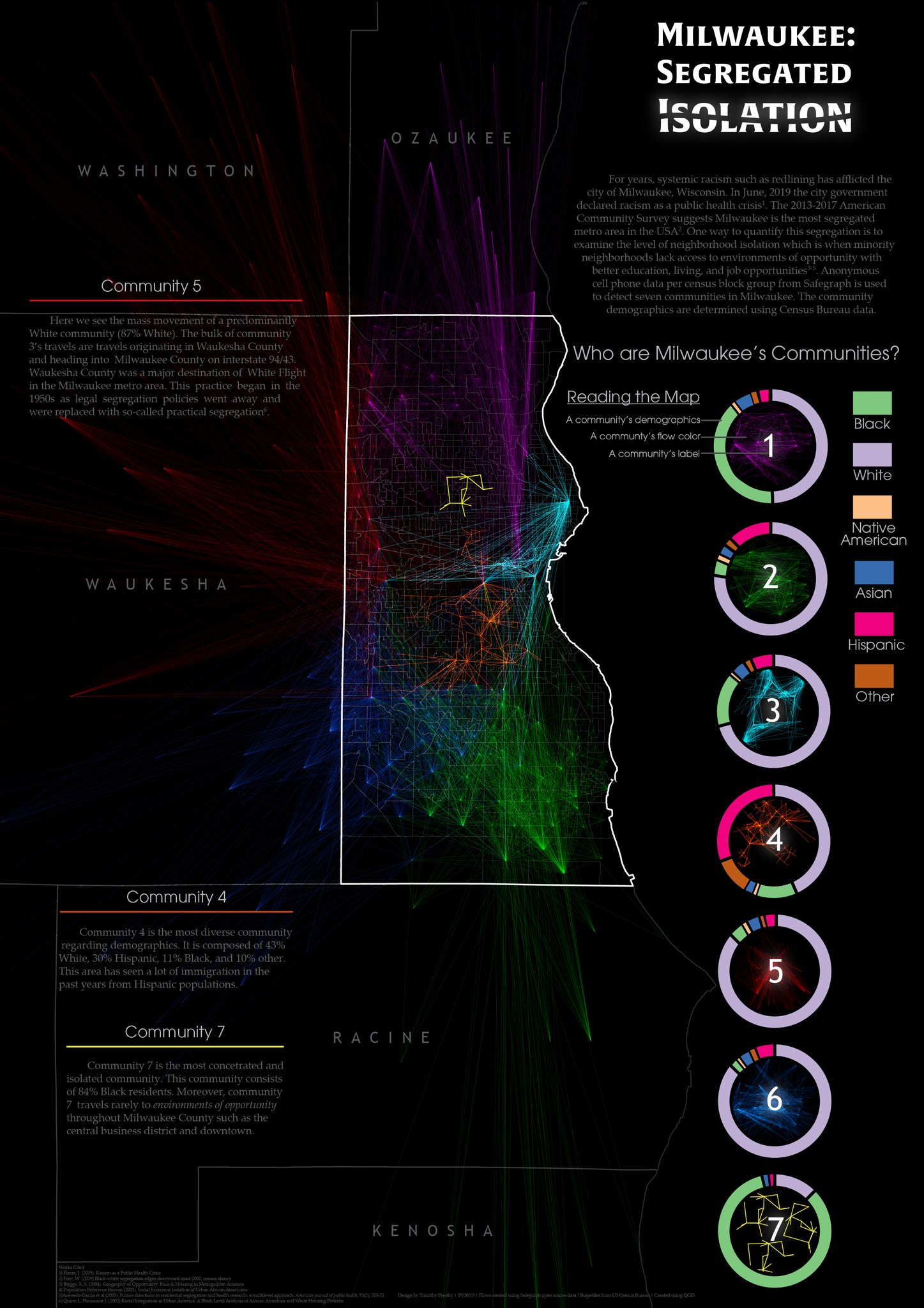
(1) We created geovisualizations to identify isolated neighborhoods by examining spatial interaction patterns of different racial groups in Milwaukee. [Paper] [Map]
(2) During the pandemic, we investigated how racial and ethnic heterogeneity influenced the spread of COVID-19. [Paper] [Code]